
A Hidden Gem on the Appalachian Trail
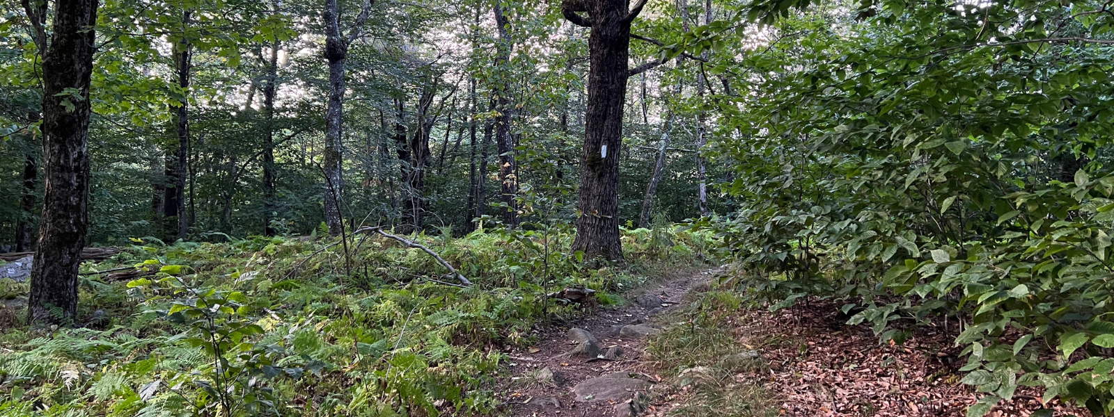
When I crossed the border from Connecticut into Massachusetts, the swelteringly hot Mid-Atlantic summer of 2022 finally relented, and I was greeted with cooler temperatures and the clearest springs I had seen since Virginia. This is easily some of the prettiest trail I’ve seen in a long time, I wrote in my journal.
I didn’t know it then, but the next 200 miles would be my favorite section of the entire Appalachian Trail. The next 90 miles through the Berkshire region were stunning, culminating with the 3,491-foot-tall Mt. Greylock, the highest and most beautiful peak in Massachusetts.
What Makes the Appalachian Trail in Massachusetts Special?
Babbling creeks and cascading waterfalls lined by mossy boulders, evergreen forests, and forgiving terrain that undulated at gentle slopes without punishing hiker knees—this was unlike any section of the trail I had seen in weeks. Since Pennsylvania, all the hikers and animals in these woods had been baking under the ever-present sun.
The shimmering heat led to a strange hush along the trail, punctuated only by raspy-sounding cicada calls and even the occasional warning from a timber rattlesnake. But now, in the cooler, shady forest, I was hearing birdsong, frogs croaking in streams, and gurgling water running underneath it all.
Surprisingly, Massachusetts rarely gets the recognition it deserves on lists of the most scenic sections of the Appalachian Trail. Hikers often focus on the Shenandoahs, the White Mountains in New Hampshire, and of course, Maine. But for me, this was one of the few sections I’d hike again in a heartbeat.
History Along the Trail: The Mohican Homeland
The Berkshires are not only a gorgeous part of the Appalachian Trail, but they are also rich in cultural history. This region was home to the Mohican people, who inhabited the Hudson River Valley for thousands of years before the arrival of Europeans. The Muh-he-con-neok, the “People of the Waters That are Never Still,” were forced to move many times, ultimately relocating to Wisconsin, but their memory remains.
Along the trail, I saw posted signs reminding hikers of this:
"You are traveling through the homelands of the Mohican people, the indigenous inhabitants of this land. Please respect this land during your journey."
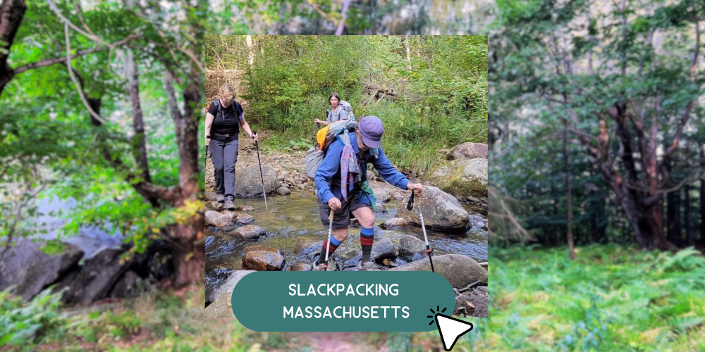
As you walk this section of the trail, Slackpacking allows you to take more time to be present, immersing yourself in the natural beauty and historical significance of the landscape. Unlike traditional backpacking, Slackpacking offers the best of both worlds—hiking without the burden of carrying a heavy pack while enjoying comfortable accommodations at night.
Where You'll Stay: The Historic Villa Favorita
Your lodging for this trip, Villa Favorita, is also steeped in history. The home sits by the edge of a field with a garden and blackberry patch, surrounded by 25 acres of woods. Built in 1918 and upgraded soon after by Clive Livingston Duval I (father of a Virginia Senator of the same name), it later became the home of Prince and Princess Sapieha, who fled Eastern Europe during WWII.
The estate’s pastures, equestrian fields, and orchards have since evolved into wild meadows, cultivated berry fields, and walking pathways through forests of pine, maple, and fruit trees.
The Scenic Highlights of the Massachusetts Appalachian Trail
Climbing Mount Everett & the Taconic Range
The border of Massachusetts begins on the slopes of Bear Mountain. Compared to the mid-Atlantic and Connecticut, the climbs in Massachusetts are longer but well-graded, making for a rewarding hiking experience.
As your Slackpacking adventure begins, you’ll set foot on the trail at the Housatonic River trailhead near Great Barrington, MA. The first climbs of the trip will reward you with breathtaking views of the South Taconic Range, including:
→ Mount Bear
→ Mount Race
→ Mount Everett (a rocky peak with long-range views)
→ Mount Bushnell
The surrounding landscape is dotted with blooming magnolias, poppies, milkweed, and wild indigo, and along the way, you might spot orange-spotted newts, wild turkeys, deer, and woodchucks.
Insider Tip: Ice Gulch
Before we finish our first day at the Route 23 crossing, you’ll pass Ice Gulch, where the Appalachian Trail winds alongside the western edge of a deep ravine within a dense conifer forest. Due to its unique shading and depth, snow can linger at the bottom of the gulch until midsummer! On hot days, it’s the perfect place to cool off and enjoy the shade.
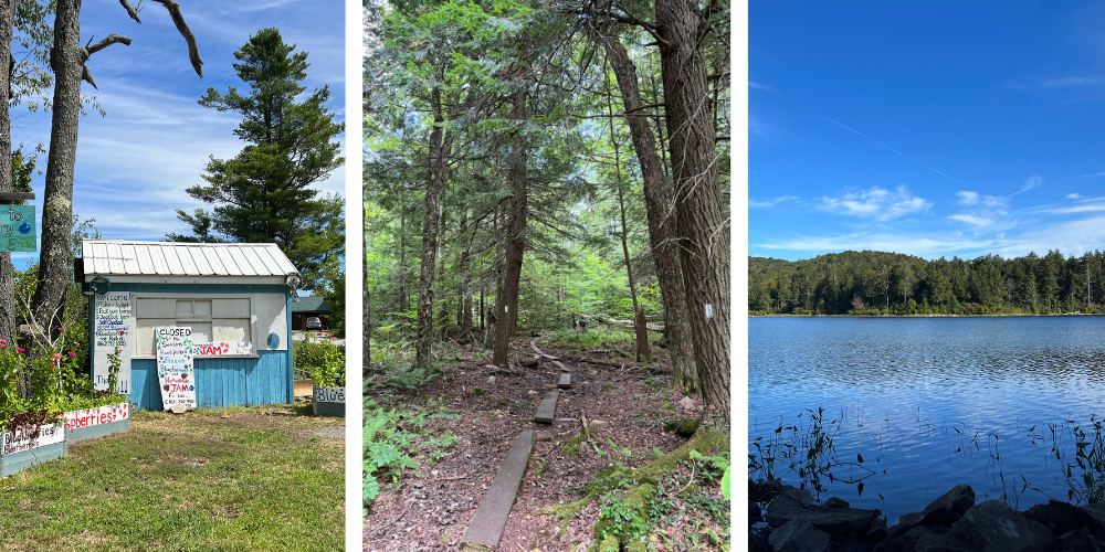
Slackpacking Through Charming Trail Towns
One of my favorite stops on the trail was Dalton, Massachusetts, an officially recognized Appalachian Trail Community. For thru-hikers, walking into a town knowing you’re welcome is a relief. Dalton offers great opportunities to resupply, enjoy a warm meal, and experience New England hospitality.
The Grand Finale: Summiting Mount Greylock
Your Slackpacking adventure in Massachusetts will end with the most spectacular summit of all: Mount Greylock. Standing at 3,491 feet, it is the highest peak in Massachusetts. But don’t worry—while the climb is formidable, the trail is well-graded and manageable.
At the summit, you’ll be rewarded with:
→ Panoramic views of four states and five mountain ranges
→ A rare boreal forest ecosystem, Massachusetts’ only subalpine environment
→ A hidden pond with a historic cabin nestled among the trees
It’s easy to miss this tiny pond and cabin, so keep an eye out as you ascend!
Why Slackpacking Massachusetts is the Best Way to Hike
Slackpacking trips combine the best of both worlds—a long, rewarding day of hiking followed by a hot meal, shower, and a comfortable bed at the end of the day.
You’ll gain and lose just around 2,000 feet of elevation daily, hiking anywhere from 8 to 14 miles per day. This itinerary allows you to fully experience the Appalachian Trail in Massachusetts without the strain of carrying a heavy pack.
Join us for an unforgettable journey on Slackpacking Massachusetts, where you’ll immerse yourself in breathtaking scenery, fascinating history, and the ultimate Appalachian Trail adventure!
